Te Mahere Urutaunga mō Te Takutai o Manukau Harbour East
Manukau Harbour East Shoreline Adaptation Plan (SAP)
The Manukau Harbour East SAP considers the future of council-owned land and assets across the region's coastal areas in response to the impacts of coastal processes, climate change, erosion and flooding.
About the Manukau Harbour East SAP
The Policy and Planning Committee approved the Manukau Harbour East SAP on 10 October 2024.
This SAP covers an area of about 5905ha and follows about 90km of coast. It covers the shoreline from Puhinui Reserve in Wiri to Taumanu Reserve in Onehunga Bay and the shorelines of:
- Māngere Inlet
- Puketuku Island / Te Motu Hiaroa
- Wiroa Island.
This SAP area has a diverse shoreline environment including sandy beaches, inlets, high steep cliffs and wharves. It has a mix of residential, rural, industrial and commercial land uses, including Auckland International Airport and Onehunga Port. The area also has large areas of park land and culturally significant land.
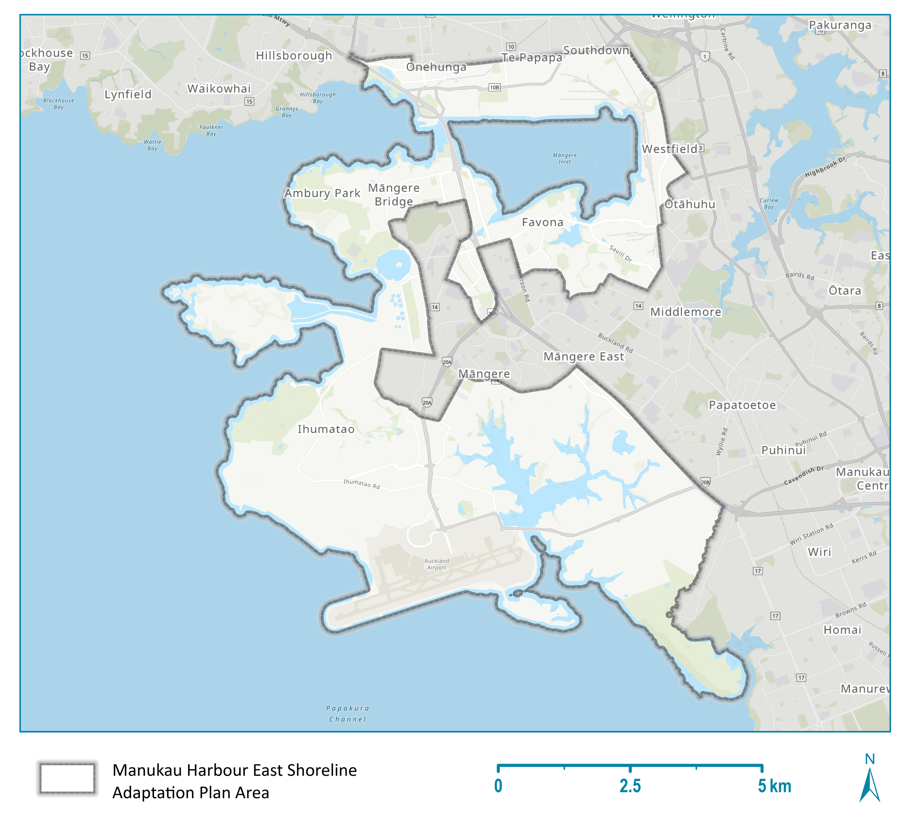
Map of areas covered by the Manukau Harbour East SAP

Map of the area covered by the Manukau Harbour East Shoreline Adaptation Plan.
Stages of the Manukau Harbour East SAP
Manukau Harbour East SAP - full report
Manukau Harbour East SAP community objectives
We developed key community goals based on feedback from our public consultation. These goals identify what matters most to people in the community.
They include:
- walking, cycling, water-based sports and family activities in coastal spaces
- maintenance of coastal walkways and boat ramps
- concerns about climate change-related hazards like storms, floods and erosion
- historical and cultural coastal connections
- protecting native species and natural coastal features
- concerns about water quality.
Read the full community objectives report
Related topics
Is the information on this page helpful?
It is helpful for us to know what works well for customers.
You will not receive a reply. Do not include personal information.
